Monday, June 17, 2013

Single or Multi-Day Pros & Cons - Chapter 2: The Multi-Day Backpack Summit

 In my last post, I spelled out the pros and cons of the single-day summit.  While I am biased towards that method, I understand the reasons why people want to do the trip as a multi-day backpack.  However, lack of training and preparation are not valid reasons for a multi-day attempt.  If anything, a successful multi-day trip requires more preparation than the already stiff requirements for a successful single-day summit.


Read warning labels before use

 The Multi-Day Main Trail Backpack: 

  •  Pro:  More permit latitude.  A multi-day-er has 14 days to get her done on the same permit provided we declare our intention to do so on the application and stay inside the Mt Whitney Zone.  Our permit "day" references the date we enter the John Muir Wilderness, about .9 miles from the trailhead at Whitney Portal.  That's because the permit also covers camping at Lone Pine Lake, just before the Mt whitney Zone starts. If the weather turns for the worse, we can hunker down (safely!) and wait until it blows over.  Then we try again the next day from either Outpost or Trail Camp provided you made allowances for extra days and the provisions hold out.  Don't worry.  No one will arrest you if you come out early or late.  The USFS understands the vagaries of mountain travel.  Weather or injury can alter your schedule.
  • Pro:  Visit more stuff.  Since the permit can last 14 days, design a comprehensive trip to visit all the interesting topography in the basin or bag another local Fourteener like Mt Muir (approach from Trail Crest).  I've always wanted to visit the plateau north of the switchbacks.  It looks like the Moon.  
  • Con:  Acclimatization  becomes even more important.  Again, it's one thing to visit high altitudes and a whole 'nother smoke to stay overnight.  Contrary to popular belief, there are no shortcuts to proper acclimatizing. Take all the Diamox you want.  The side effects are altered sense of taste, drowsiness, dizziness, nausea, vomiting, increased sunlight sensitivity...wait a minute.  Sounds a lot like altitude sickness.  At least we can cure altitude sickness by going back down.
  • Con:  Contributing to "The Sewer." The longer one stays in the Whitney Zone, the more likely one needs to relieve oneself.  Since the solar toilets were removed, the amount of poo near the trail and the camps increased dramatically, especially since many people refuse to adhere to mandatory Leave No Trace ethics and pack it out.  Therefore, I refer to Lone Pine Creek as The Sewer. 
    The World's Loveliest Sewer
    Don't even think about drinking that water without filtration.  Don't even think about digging a hole and burying waste, either.  Wherever you dig, someone already beat you to it.  "Wag Bags" are issued at the Eastern Sierra Interagency Center with every permit. Purchase additional bags at your local backpacking retailer. Take one apart with your group.  See how it works.  You may not have time to read directions when The Urge strikes.  If packing out your waste is beyond your ability, please stay home.  Please.
  • Con:  Increased exposure to objective dangers.  Violent bad weather, high wind gusts, and rockfall take their toll.  More hours up high mean greater exposure.  If I owned a $400 Supercalifragilistic Ultralight Goat Bladder Mark III tent, seeing it in tatters would make me cry.
The multi-day trip is no easier, thanks to greater pack weights and the longer altitude stays.  I believe multi-day trips are responsible for the great percentage of failed summit attempts due to this mistaken assumption.  The grand majority of Whitney climbers would be served better by preparing themselves properly for a single day trip of 16 hours or less.  Remember the question I posed at the top of the previous post on single-day trips.

Having said that, some climbers want the "expedition assault" feel of a multi-day trip with gear.  If that's your bent, consider a real multi-day adventure jumping off from Horseshoe Meadows or the High Sierra Trail all the way across Sequoia National Park.  By the time you approach Mt Whitney proper, you'll be much better acclimated than trying to blitz all the weight up and down quickly.

If you're looking to spend lots of time in the Whitney Zone knocking out every prominent knob in the area, then the Main Trail multi is unavoidable.  However, don't short-change your conditioning or acclimatizing.  Remember this old saying:  Climbers summiting Whitney from the west are the ones with smiles on their faces.  Climbers summiting from the east are the ones throwing up on their shoes.

Single or Multi-Day Pros & Cons - Part 1: The Single Day Summit

When most people visualize their first Mt Whitney expedition, they see it as a multi-day backpacking trip.  Oak-handled ice axe in hand, outfitted in knickers and knee socks, they utter pithy phrases like, "Onward, Tenzing!" Or maybe that's just me.

Regardless, most Whitney-goers view the multi-day trip up the Main Trail as the easier mode of travel.  But is it?  Here's the $64,000 question:  Would I rather carry 30 (plus?) pounds up 6 miles and 4,000 vertical feet or carry 12 pounds up 10.8  miles and 6,000 vertical feet? 

Metric translation:  Do I want to carry 13 (plus?) kg up 9.7 km and 1,219 m or carry 5.5 kg up 17.4 km and 1,829 m?  

Might I suggest the latter might be easier?

Consider the single-day hike with its lighter loads and less time at altitude
 
Here now are the pros and cons for the single day attempt:

The Single-Day Main Trail Hike:

  • Pro:  More permit spaces available.  Single day quota is 100 per day on the Main Trail versus 60 for overnight permits.  Yes, single day trips up the Mountaineer's Route eat into this total but that's usually less than 10 per day.  So we're still looking at 30 extra slots every day.
  • Pro:  Sleep low, climb high.  No need to expose ourselves to high altitude any longer than necessary to do the job.  For many overnight-ers, the next step after attaining Trail Camp at 12,000 feet (3,658 m) is hiking back down after spending the whole night puking.  Visiting 12,000 feet is a hell of a lot different than staying at 12,000 feet.  Sleep comes easier at Whitney Portal's relatively low altitude of  8,000 feet (2,438 m).  If you're hell-bent on a multi-day trip, stay at the lower-altitude Outpost Camp instead.  Your digestive tract will thank you.
  • Pro:  Eating a victory burger at the Portal Store vs trying to eat another meal at altitude.  While descending on our last trip,  my stepdaughter Natalie announced, "I hope you realize we are eating at the Portal Store when we're done."  I had to admit the thought of Doug Thompson placing a big juicy burger in front of my mug had a lot of appeal. 

Dawn approaches just before Trail Camp

  • Con:  Must wake up at an ungodly hour to assure summiting before noon.  Last time we woke up at 2:00 am to hit the trail by 3:15 am.  Being off the summit around noon to miss the afternoon killer lightning/hail/sleet/snow storm requires an "alpine start."
  • Con:  No latitude for bad weather.  If our day is July 27 and the daily hail/sleet/snow storm arrives early, stays late, and packs electrical potential, we're done.  There are no mulligans for Mt Whitney day hikers.  We must submit ourselves to the permit process again by going back down to the Eastern Sierra Inter-Agency Center.  Regulations bar a second attempt during the next calendar day. So the earliest next attempt sits two days away provided permit space exists.
In the next post, I'll break down the multi-day summit attempt.

Like Mt Whitney Quest on Facebook 

Friday, June 7, 2013

Mt Whitney At-A-Glance (Geography and Glossary of Terms)

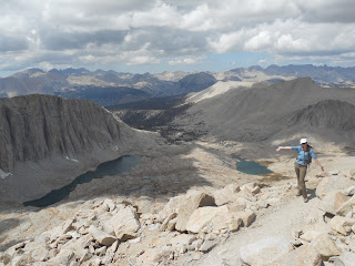
Ms Natalie directs us to Mt Whitney
When presenting a Mt Whitney lecture, I lay out the geographical particulars of a Mt Whitney Main Trail climb.

Mt Whitney by the Numbers:


Elevation:  14,508 feet - 4,422 meters
Trailhead Elevation:  8,360 feet - 2,548 m
Vertical Rise from Trailhead:  6,148 feet - 1,874 m
Average Rate of Climb:  569 feet per mile - 108 meters per kilometer
Trailhead-to-Summit Distance:  10.8 miles - 17.4 km
Trailhead-to-Outpost Camp Distance:  3.8 miles - 6.1 km
Trailhead-to-Trail Camp Distance:  6 miles - 9.7 km
Trailhead-to-Trail Crest Distance:  8.8 miles - 14.2 km
Trail Crest-to-Summit Distance:  2 miles - 3.2 km

Lone Pine, CA (pop 2,035):  The closest town of any size to Mt Whitney located on CA Rte 395.  Go west at the stoplight on Whitney Portal Road about 13 miles (21 km) to reach the Main Trail.  Lone Pine has a post office, grocery store, restaurants, an excellent expedition and climbing outfitter, and hot showers.  Elevation 3,727 feet (1,136 m)

Lone Pine Camp:  Not to be confused with Whitney Portal, this car-camping area is six miles from the town of Lone Pine and serves as the jump-off point for winter mountaineering expeditions up Mt Whitney (Whitney Portal Road is closed for the winter past Lone Pine Camp).  Camp can be brutally hot in the summer.  Elevation 6,000 feet (1,829 m)


Whitney Portal:  Location of Mt Whitney Main Trail trailhead as well as a beautiful car camping area.  Also location of the Whitney Portal Store selling souvenirs, showers, hot food (try the pancakes), snacks, and beer.  Note:  No permit necessary to camp at Whitney Portal but reservations strongly recommended.  They do keep some campsites open on a first-come-first-serve basis.  Check in with the campsite superintendent. Elevation 8,000 feet


The Superintendent is in

Main Trail:  The most heavily traveled route to the summit.  Not to be confused with the Mountaineer's Route.  Permit required past Lone Pine Lake.

Lone Pine Creek:  The watershed through which the Main Trail meanders.  The creek originates as a spring above the tarn at Trail Camp and flows all the way back to Lone Pine.  Lone Pine Creek constitutes the main source for drinking water along the Main Trail.  You brought your water filter, right?

Mountaineer's Route:  Also known as the John Muir or North Fork Route.  A very direct alternate route first pioneered by John Muir.  Requires Class IV climbing knowledge with exposure.  Permit required but which permit depends on whether an overnight stay on the Route is part of the plan.

Mt Whitney Zone:  Area around Mt Whitney requiring a permit to enter.  The Mount Whitney Zone begins just above Lone Pine Lake on the Main Trail,  above Lower Boy Scout Lake on the Mountaineer's Route, and above Crabtree Ranger Station on the John Muir Trail when approaching from the west.  This map shows the entire Zone in a good scale.

Lone Pine Lake:  A popular day hike destination comprising the first three miles (4.8 km) of the Main Trail.  No permit required to visit this lovely glacial tarn perched at the edge of a cliff.

Outpost Camp:  The lower of two primitive backpacker camps located at the west end of an upland meadow called Bighorn Park.  Staying there requires a Mount Whitney Zone Overnight Permit.  Note:  The NPS removed the toilet facilities a few years ago.  All waste must be packed out.  Elevation 10,365 ft (3,159 m).

Your Official Government-Issue Poop Kit

Trail Camp:  The higher of two primitive backpacker camps located in a rocky, wind-scoured basin.  Staying there requires a Mount Whitney Zone Overnight Permit and a good dose of previous altitude acclimatization.  Note:  The NPS removed the toilet facilities a few years ago.  All waste must be packed out.  Good times.  Elevation 12,000 ft (3,700 m).

The 97 (or 96 or 99) Switchbacks:  The trail section winding its way up and out of a cirque between Trail Camp and Trail Crest.  The switchbacks gain approximately 1,650 feet (503 m) of elevation in about 2.3 miles (3.7 km).  This is the steepest section on the Main Trail.

Trail Crest:  A narrow pass from the east side of the ridgeline to the west.  Trail Crest also marks the entrance to Sequoia National Park.  Elevation here is 13,600 feet (4,150 m).  The John Muir Trail joins the Main Trail about 1/10 mile (161 m ) west of Trail Crest and about 200 vertical feet (61 m) below.  So yes, there is uphill on the way back down.  The view made my stepdaughter Natalie's knees buckle.

Summit Hut:  Built 1909 in part with funds from the Smithsonian Institution who used it for solar study and observations of  Halley's Comet.  Hut is open but not to be used as refuge from electrical storms.  Many climbers find this out the hard way, most of whom are dead.


Did I leave anything out?  Please comment with suggestions for further stat or glossary additions.

Like Mt Whitney Quest on Facebook 


Monday, June 3, 2013

So Ya Wanna Climb Mt Whitney, Eh?


70 percent of all Mt Whitney summit attempts end in failure.

 There, I mentioned the elephant in the room.  The most current statistics available for Mt Everest (2012) show a failure rate of 56 percent.

Why the discrepancy?  Most people throwing down 60 grand for an Everest trip complete the necessary steps to prepare themselves for climbing it.  Once at the 17,000-foot base camp, climbers acclimate gradually to ever-increasing altitudes for at least a month before making a serious bid for the top.  Most of them are clients of commercial concerns unwilling to assume the risk for any client deemed unprepared by the guides and Sherpas.  So that 56 percent failure rate reflects a preliminary weeding-out process done by the more reputable commercial outfits.  There is no such process for climbing Mt Whitney.  The mountain is open to anyone with 15 bucks and an additional six-dollar application fee.


The number one reason for failing to summit Mt Whitney remains the complete lack of preparation for the rigors and hazards of the climb.  Most people underestimate altitude effects and overestimate their level of conditioning.  Some feel their incredible mental toughness or their heroic ignorance of any potential pitfalls will win the day.  Unfortunately, these dubious strategies put not only the strategists at risk, but also anyone obligated to rescue them.  That could mean a Medevac with all the trimmings or fellow climbers already pushing themselves to their limits.
Call 911?  Really?
Of course it's hard to arrange a rescue if nobody knows you need one.  Believe me when I tell you your phone has about as much chance of working on Mt Whitney as a pizza delivery to the summit.  That means someone must go all the way down to the Whitney Portal Store and pray that Doug, Doug Jr, or Earlene Thompson is still there to call down to Lone Pine.  Otherwise, add that Lone Pine trip on to the time necessary to mount a rescue.


Preparation for Mt Whitney takes time.  To do it safely and successfully means we can't just wedge Mt Whitney into our busy schedules.  We must schedule ourselves around Mt Whitney.  Success or failure to summit Mt Whitney depends largely on our ability to prepare ourselves physically, mentally and materially for the task at hand.  It's a total garbage-in-garbage-out proposition.

There are some factors which can't be overcome by preparation.  One is always at the mercy of the weather.  Lightning is an extremely dangerous high attitude hazard.  Remember, Mt Whitney is the highest point for 1,630 miles.  Rockfall occurs often along the trail as well as other hazards.  However, tripping and falling because your legs are baked can be prevented by conditioning and acclimating properly.


Wanna be rubber-legged here?

So what constitutes proper preparation?  Much of this blog's content will be dedicated to that very subject.  I'll provide workable plans and acclimatizing strategies for CA residents, other western state-ers and those who live in areas lacking good training altitude.  Regardless of where we reside, our preparation requires perseverance and perspiration.  Lots and lots of perspiration.

Like Mt Whitney Quest on Facebook  

WELCOME! READ THIS FIRST

REI Gregory Osprey Deuter Lowa Vasque Keen Merrill Harrison Maps

Please remove your shoes before entering Mt Whitney Quest

Thank you. The carpets here are brand new and I'd like to keep them that way as long as possible. Now that that's settled, thank you for for joining me here on this server located somewhere near Peshawar I'm sure. If you're unsure of Peshawar's location, get out your world map and find a country with cheap labor that hates us. Peshawar will be pretty close.

By the way, if you like acerbic humor, keep it parked right here.

Disclaimer:  The opinions expressed herein on each and every blog post are those of the author(s) and do not necessarily reflect the positions, beliefs, morals or standards of any of the author's employers, co-workers, family members or friends unless otherwise noted.

The high-minded purpose for creating Mt Whitney Quest is providing a clearinghouse for real solid beta backed up with experience.  There are a lot of misconceptions around climbing Mt Whitney so rumor quashing will be a large part of what goes on here.

The low-minded purpose for creating Mt Whitney Quest is finding a way to monetize my outdoor lifestyle.  How's that for full disclosure?  Don't worry, kind reader.  I will never charge for your eyeballs.  Someone once said,  "If you want to make a small fortune in the outdoor industry, start with a large one."  I'll let you know how it all works out.

L to R:  Myself, Andy Hindoyan, Rodney Hsueh representing REI Arcadia, CA at the JanSport 8000-Meter Challenge

So what makes me think I'm some kind of expert?  Well, I climbed my first mountain in 1966.  Mt Carmel, aka The Sleeping Giant, towers 739 dizzying feet above Hamden, CT.  I took my first backpacking trip in 1969.  I took my first multi-week backpacking trip as a 16-year-old in 1972.  That trip resulted in an end-to-end of Vermont's Long Trail in 20 1/2 days.  A thousand mountains and a hundred thousand trail miles and here we all are.

My first foray up Mt Whitney was as a 46-year-old in 2002.  My friend Cory Walsh asked me the age-old question, "If not now, when?"  I had no answer for her so we commenced preparation.  

In a previous life,  I competed as a track & field athlete for 15 years and coached high school track for five.  To create a plan, I blended my outdoor experience with my training and physiology knowledge.  We needed to improve our oxygen uptake as well as acclimating to high altitude. To facilitate our goals, I came up with a list of hikes in our local (to LA) mountains.  Here in SoCal, we are lucky to have mountains over 11,000 feet for training, backpacking and general pleasure walking.  This hike program is designed for adapting the body gradually to stress.   I use running to augment the muscle-and-altitude aspects of the hikes.  More on this to come.


Since 2006, I lecture on climbing Mt Whitney (as well as other outdoor subjects)  through REI Outdoor School.  I also do pic-filled Powerpoints for private parties and groups.  Through my classes, the hike list I alluded to earlier became known as the infamous Mt Whitney "Dirty Dozen."  These are eleven hikes ramping up in mileage, vertical rise and ultimate altitude as one completes the list.  The 12th hike is the mountain named by members of the CA Geological Society after State Geologist Josiah Whitney in the ultimate underling / boss suck-up.

Our first Whitney foray ended with a successful summit attempt after a seven-hour ascent from Whitney Portal with a six-hour descent.  Actually, we would've climbed it in six hours, save for a solo climber who joined us the night before.  He kept falling behind and we kept waiting for him.  I guess he summited faster than he originally planned.  He looked a little green from doing so.

On that first trip we saw some people in real distress.  That planted the seed for the lectures and subsequently, this website.

Since then, I've summited numerous times, highlighted by a 12-hour solo round trip (six hours up, five down, one at the top), a 15 1/2-hour round trip where we were chased off the top by lightning and proposed to my wife Robin (she said yes, thank God.  That could've been a long hike back down), and last year's 13-hour round trip with my youngest stepdaughter who was in such good shape, she was rock-hopping for fun at 14,000 feet.


REI Gregory Osprey Deuter Vasque lowa Keen Merrill Sequoia Inyo

In ensuing posts, I'll lay out a training plan, acclimatizing strategies, the single-day versus multi-day trip (I like single days better), and describe the whole Dirty Dozen hike by hike.  Since many of you want to climb Mt Whitney from other areas of the country (world?  Solar System?), I'll spell out ways to prepare in more altitude-challenged areas.

Like Mt Whitney Quest on Facebook