Tuesday, December 31, 2013

Running and Climbing: A Proven Recipe for Mt Whitney Success - Part III - Use a Heart Rate Monitor

Heart rate monitors provide valuable feedback whether we're in our running or climbing phases.  Knowing our heart rate makes training time as efficient as possible.  Here's how:


Meme courtesy Robin DeCapua

There are two basic training modes; aerobic and anaerobic.  The former literally means "with air" while the latter is the opposite.  Training aerobically means the body's demand for oxygen does not outstrip its ability to supply it.  Aerobic training runs are longer and less intense.

Anaerobic training refers to a specific ability to do work in the absence of oxygen, commonly referred to as "oxygen debt."  Anaerobic training runs are shorter and far more intense.  Interval training on the track and repeats on hills are two examples.

For our high-altitude purposes, we're relying on the running to improve our oxygen-carrying capacity.  Running at certain intensities improves the whole system by strengthening the heart muscle and creating a larger network of capillaries probing deeper into muscle tissue.  We achieve this goal more efficiently by using the heart rate monitor and capping our maximum heart rate while remaining "in the zone" for longer periods.

Say Hello to Aerobic Max

Depending on our age and physiology, each of us has a maximum aerobic potential.  Generally, aerobic max lies around 75-80 percent of our maximum heart rate (you can find your rough maximum heart rate for training by subtracting your age from 220).  If you are overweight or sedentary or both, your aerobic max may be lower, at least for now.

A warning before we go further:  Consult your physician before embarking on any training regimen.  Also, trainees may require less intensive training to work up to their maximum aerobic potential.  Being more ambitious than your body's ability to adapt is a well-worn pathway to injury so ease into it.

Chart courtesy Wikipedia

For most of the population, the heart rate for maximum aerobic potential lies somewhere between 130-160 beats per minute.  Use the chart above as a guideline, at least to start. Training near maximum aerobic potential creates the maximum amount of blood volume and pressure, thereby forcing capillaries deeper and deeper into muscles.  The more we develop our capillary network, the easier it is to provide working muscles with oxygen and glycogen.  Having an underdeveloped circulatory system starves muscles for oxygen and glycogen just as sure as trying to eat by sucking a turkey through a straw.

Running at sustained levels above maximum aerobic potential creates two major problems.  First, the heart beats so rapidly, the valves slam shut before the chambers are full so the overall volume and pressure go down.  Second, lactic acid forms in the muscles in the absence of adequate oxygen supply.  Slowing down allows us so achieve our stated aims; improving cardiovascular efficiency and maximizing training time.

Mount Whitney Training
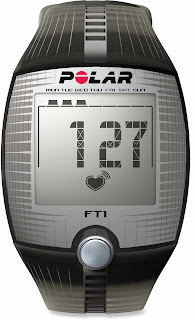
We use the heart rate monitor to ride herd on ourselves. For our purposes, even the simplest monitor will do.  I use a Polar FT1 retailing for $59.95.  The display shows heart rate while in training mode.  I can set maximum and minimum heart rate alarms.  Set them at least five beats above your aerobic max, otherwise you'll go crazy with the alarm beeping.  Afterwards, I can see my exercise time plus max and average heart rates.  That's it.  So don't break the bank needlessly.

Also, my heart rate monitor uses a chest strap transmitter.  In my opinion, non-chest-strap monitors are a waste of money.  Some require stopping for 20 seconds while placing a finger on a pad.  Save your money and take your pulse instead.  Others don't get the finger but they are still inaccurate.  A monitor with a chest strap is plus-or-minus one beat-per-minute accuracy no matter the price or manufacturer.  You'll get over the strap in about 30 seconds.

The Moving Threshold


Above 10,000 feet, my "aerobic threshold" drops about ten or 15 beats.  That's why I advocate using the monitor while climbing as well.  If I exceed my adjusted threshold, I get about 20 minutes before my legs are smoked.  No amount of rest stops will revive them for long.  Five or ten beats below my aerobic threshold and I can climb until next Tuesday.  Having said that, sometimes I induce oxygen debt on purpose during training climbs for short stretches to increase my anaerobic capacity.  More on that in the future.

We are all "prisoners" of modern life.  We are all busy and oversubscribed.  Get the most from your valuable training time.  There is no excuse for neglecting your training.  Others are counting on you.  Give yourself the best possible chance to summit.  Start now and adapt.  Climb.  Run.  Monitor.  Succeed.  Enjoy.

 Like Mt Whitney Quest on Facebook

Tuesday, December 3, 2013

Running and Climbing: A Proven Recipe for Mt Whitney Success - Part II - Mt Whitney for Runners

Part I presents my argument for running as one part of a three-pronged training program.  The other two elements are climbing and altitude acclimatization. Part II explains to habitual runners the necessity for climbing as high as possible as often as possible.

http://mtwhitneyquest.blogspot.com
Robin and Natalie:  Runners. Climbers.  Mt Whitney summit-ers.
First of all, I've been running since The Beatles were still a band.  As I've outlined in many previous posts, I've both competed and coached.  I know firsthand the runner's mindset.

"I run, therefore I am invincible"


For instance, most runners believe running inoculates them from pretty much every malady short of AIDS.  They eat what they want and as much as they want.  They do get fewer illnesses and use less sick time.  For a large percentage of runners, this belief is justified.

Unfortunately, this belief crashes to the ground when climbing high.  First, altitude can affect a person psychologically and physiologically regardless of one's physical condition.  Second, distance running is nowhere near as muscular as climbing.  A good, stiff running hill climbs at maybe 300 feet per mile (57 meters per kilometer).  There are climbs on my Mt Whitney Dirty Dozen list with sections in excess of 1,250 feet per mile (237 m/k).  Mt Whitney itself averages 569 feet per mile (108 m/k).  So we're no longer gliding effortlessly over the ground using as little muscle as possible.  We're using our quads, hammies, glutes and core muscles to a much greater degree.  Plus, we're wearing a pack.

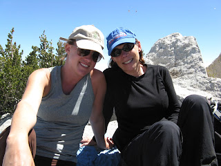
The Coffee Hikers from Pasadena, CA:  Runners.  Climbers.  Mt Whitney Summit-ers (Tamara Silver photo).
 So we have to practice at high altitudes to ready ourselves for even higher altitudes.  Climbing is more like circuit training with a gazillion reps than like running.  Our legs and core lift our body-and-pack-weight over and over again.

24 hours?  Really?


I heard one three-time marathoner brag about how she went up and down Whitney in "less than 24 hours"  having spent little or no time at altitude prior to the climb.  That's way too long.  I can't even sleep that long.  My wife Robin, whose lifetime longest run is 8 miles (12.9 k), who ran no longer than 6 miles (9.9 k) while training for Whitney, went up and down in 15 1/2 hours.  She did it in far less time because she spent a lot of training time climbing high.  After we were done, Robin told me next time she would spend even more time preparing up high.  Meanwhile, Marathon Woman may never do another 14-er again.

Charles Hirsch:  Runner.  Climber.  Cosmo Centerfold Eye Candy.  (Charles Hirsch photo)
 No matter our sporting background (or lack thereof), we all need the same basic preparation.  We must increase our cardiovascular efficiency, climb with a pack for muscle building, and climb high to acclimate.

But wait, there's more...


Having said that, we know running will improve our climbing.  However, my own "experiments" show climbing also improves the running!  When I reach the 5-digit altitudes with the Mt Whitney Dirty Dozen, my average running pace drops a minute per mile. Hills melt away under my feet.  Instead of plodding up three-mile inclines on distance runs, I start looking for ways to shave more time.

All that time climbing steeply up in the thin air improves everything.  Your running in a rut?  Bust out by busting up.  When life gets you down, climb up.  Altitude affects attitude too.

Like Mt Whitney Quest on Facebook 

"We Interrupt This Program...."

Unfortunately, Google has disappeared my really cool (at least I thought) blog background photo so we're all swimming in the middle if this green pool for the moment.  Both Google and I are working on it plus I'll have two more posts for you in short order.


Update:  The background photo doesn't show up with my Foxfire browser.  Seems to be fine in Internet Exploder.
Update update:  It works for Chrome users as well.  Perhaps it's just me.....

Friday, November 8, 2013

Running and Climbing: A Proven Recipe for Mt Whitney Success - Part I - Why Run?

In previous posts I alluded to the importance of running for a successful Mt Whitney trip.  Yes, I can hear the knives sharpening from here.  My background as a track & field athlete and coach led me to design a program for my first Whitney climb.  I followed it for each subsequent attempt and summited last year in 7 1/2 hours despite a sinus infection, fever, and being 56 years old.  My conditioning carried me through and allowed me to enjoy myself thoroughly despite my maladies slowing me down.

Many people have found success since I came up with the running program, the Mt Whitney Dirty Dozen, and the somewhat novel concept of actually respecting what one is doing enough to prepare properly.

http://mtwhitneyquest.blogspot.com

Climbing long and hard builds muscle for propulsion, gravity resistance, and joint protection.  High altitude climbing prepares one for the physical and mental effects of reduced air pressure.  Running perfects the fuel pump keeping the whole system operating at top efficiency.  Skimping on any one lowers the effectiveness of the other two and edges the failure-to-summit rate back toward 70 percent.


The case for running.


Cardiovascular training on a daily basis forces small capillaries deeper into muscles, bringing glucose and oxygen along and enabling  them to operate for longer periods of time.  Cardiovascular training also facilitates acclimatization to high altitudes.  If one develops the cardiovascular "infrastructure" to  supply greater oxygen levels to muscles, then it stands to reason one benefits greatly when oxygen is in short supply due to altitude.

Okay, get those knives ready for this next statement:  Running as a cardiovascular exercise can create stronger joints, ligaments, and tendons as well, provided the trainee implements increases slowly enough.  Just as weight bearing exercise (like, say, hiking up a mountain and back down again with a pack) allows a post-menopausal woman to retain bone mass, the body will adapt itself to the extra stress.  We're not like machines wearing out; we regenerate.  Unless you're in a big hurry to improve and blow stuff up.

 Ouch.


Hey, I'm not immune.  I'm currently "on the shelf" with severe plantar fascitis due to too many miles in worn shoes. Injury due to poor/worn/incorrect equipment is number 2 on the Hurt Parade just behind too much too soon.  Yes, running shoes can be expensive, especially since I advocate buying them from a store with personnel trained to fit them properly.  Injury can be even more expensive.


What about biking or swimming?  Certainly they don't "pressure" connective tissue.  That's the problem.  A cyclist friend of mine took a rugged 20-mile hike recently.  Afterwards, his knees and ankles were killing him.  While he was in good cardiovascular shape, his knees and ankles could not cope with the demands placed on them by boots-on-the-ground exercise.  I'll advocate cycling as prep for Mt Whitney when they build a bike trail up there, which will be never.

Every year, people tell me they can't run due to knee/ankle/shin/eyeball/earlobe issues.  Most people's initial contact with running is school sports with rules-restricted seasons where coaches cram the available practice days with as much conditioning activity as possible.  Or, people attempt to train themselves without knowing whether their methodologies have any basis in fact. Your body adapts as fast as your body adapts and not a day sooner.  Take it easy and start early.  Your running program commences at least 6 months before your Whitney date.

How much running?


 Based on my experience, climbing Mt Whitney requires sufficient cardiovascular endurance necessary to run 5 miles (8 km) in one hour at least 5 days a week.  That's 12 minutes a mile (7:28 per km), a standard attainable by about 80 percent of the population.  Only the extremely old, extremely young, or the serially sedentary will find this standard impossible.  Persons over 65 should add a minute a mile due to loss of speed. Running at that level for the month before Whitney should do the job.  For many, achieving that level requires starting even more than 6 months prior.

So put the knives away.  Instead of creating excuses, implement a running plan that works for you.  Adapt gradually to stress.  Harden your body for the rigors ahead. Don't tear it down.  Maintaining a running program is easier when we have to be at our best on a given day rather than training for the nebulous ideal of looking better.  Get together and train with your trip partners at least once a week.  Remember, don't fit Mt Whitney into your busy schedule.  Fit your busy schedule into Mt Whitney.

Like Mt Whitney Quest on Facebook 

Wednesday, November 6, 2013

My Wife Robin is a "Meme Machime"

http://mtwhitneyquest.blogspot.com
My wife Robin can churn these out like butta.  Sometimes I come up with the wording and she helps me with the formatting and the visual aspect.  However, this one is all hers.

In the meantime, I have a bunch of new posts lined up and ready to take off.  You'll be seeing them shortly.  Thanks for tuning in!

Like Mt Whitney Quest on Facebook 

Saturday, October 5, 2013

Mt Whitney Government Shutdown Information

Okay, so it looks like the shutdown won't go away anytime soon.  I don't want to get into a political discussion about it and will not publish any overtly political comments.  I'm just trying to update everyone pertaining to Mt Whitney and act as a clearinghouse regarding what facilities are open or closed.  This post will be updated as new information comes in or conditions change.

  • Whitney Portal Road is OPEN.  The road is part of Inyo County's jurisdiction so there is no impact thus far.
  • Whitney Portal Store is OPEN.  Unless the Federales tell him to leave (which they won't),  Doug Thompson intends to keep the store open.
  • The Whitney Portal Store Bathroom is CLOSED.  No flush toilet facilities until further notice.  However:
  • The Whitney Portal pit toilet and drop-off station at the trailhead are both OPEN.
  • Whitney Portal Campground is CLOSED.  As of October 3,  Whitney Portal Campground will not allow any campers regardless of reservations.  Don't even think about camping anyway.  Almost every site can be seen from the road so renegade campers will be easy pickin's for The Law. 
  • Lone Pine Campground is CLOSED. See above.
  • Horseshoe Meadow Road is CLOSED.  There is a gate across the road where it enters federal land.  While it may be possible for motorcycles to bypass the gate, the rangers still patrol and the potential for heavy fines (four figures) remains high.
  • The Eastern Sierra Interagency Center is CLOSED.  Permitted climbers cannot pick up their permits.  For the time being, your reservation letter will act as a permit. There was a rumor Doug Thompson had all the paperwork at the Portal Store but I cannot get corroboration.  Hold onto your reservation letters.  Note:  The Agency website still says "open."  Reliable sources tell me it's not.
  • Climbers are still allowed up Mt Whitney.  For the time being anyway.   Visitors to other national parks and forests are not so lucky as federal law enforcement patrols remove visitors from the parks.
  • NEW UPDATE:  The day and overnight use parking lots are OPEN:  You won't have to cadge a drop-off at the trailhead.  You can park your car at the appropriate lot.
  • NEW UPDATE:  Rescue operations are NOT curtailed.  Doug Thompson will be at the Portal Store generally between the hours of 6:00 am to 8:00 pm.  If someone needs rescue, Doug will relay the message to 911 and the authorities will still mount a rescue.  Be careful.  Rescue may still be a long time coming, especially if Doug is gone for the night. 
Here's what we don't know yet and hope to update:
  • We don't know specifically about other areas to camp.  However, there are a few private campgrounds in the Lone Pine area with showers and everything.  The Mt Whitney Portal Hostel is operating.  All of these options are around 3,700 feet (1128 m) of altitude so they won't help your acclimatizing process.  Of course, you did your high altitude training, right?
Everything is fluid right now so this post might change dramatically as new info comes in.  Also, please don't hold me accountable if anything proves inaccurate.  I'm pulling from a number of sources so it's possible someone told me something in error or I misunderstood.  I'll fix any errors ASAP.

Good luck everybody.  I sincerely hope the shutdown doesn't last much longer.

Like Mt Whitney Quest on Facebook 

Sunday, September 8, 2013

The Mt Whitney "Dirty Dozen"

Hike #1 (Natalie Moore photo)
In a previous life, I spent 15 years competing in track & field and 5 years as a high school track coach in Bedford, MA. All along the way, I was lucky to have great coaches who made sure I understood why we were doing what we were doing. I was also interested in exploring physiology on my own to improve athletic performance.

So when my friend Cory Walsh approached me about putting together a Mt Whitney trip, I assembled a two-pronged program (hiking /running) to train for the climb. Today I will talk about the hiking /climbing aspect of training and the list of hikes I created called The Mount Whitney Dirty Dozen. Here they are in order:
  1. Malibu Creek – Backbone Trail loop 14.5 miles (23.5 km) 2,000 ft (610 m) vertical rise  2,500 ft (763 m) max elevation.  Use this hike to gauge your conditioning. You should finish this hike in under six hours including lunch break. If you cannot, and your Whitney date is less than seven months away, consider putting off Whitney until next year. Start getting yourself in shape to get in shape!
  2. Mt Lukens via Stone Canyon  8 mi (12.8 km) 3,200 ft (976 m) vert 5,068 ft (1,546 m) max el. There are only two reasons to climb Mt Lukens; To stand on the highest point in the LA city limits or to train for something bigger. Not a really pretty hike except the first and last mile, the summit is anticlimactic, and the view may be hazed out.  800 ft/mile is a good stiff test. If the creek at the trailhead is too high to cross safely, come back another day.
  3. Mt Wilson via Chantry Flat & Upper Winter Creek Trail 14 mi (22.5 km) 3,600 ft (1098 m) vert 5,710 ft (1742 m) max el. Scenery-wise, this hike is a big improvement over the last one.  Layout-wise, it’s very similar with a three mile warmup gaining only 300 feet followed by four miles of climbing at 800 ft/mile.
  4. Mt Baden-Powell via Vincent Gap  8 mi (12.8 km) 2,800 ft (854 m) vert 9,399 ft (2867 m) max el. This one should tickle your altitude bone. The real purpose is to prepare you for the next hike. On a scale of one to ten, the summit view is a stone cold 12.  The Baldy massif is spectacular. The 40-plus switchbacks get you psychologically prepared for the 97 (98? 99?) switchbacks awaiting you in a few months.
    Hike #4 (Suzanne Szalay photo)
  5. Mt San Jacinto via Tramway Trail 11.5 mi (18.5 km) 2,300 ft (702 m) vert 10,834 ft (3,302 m) max el. Our first foray into five-digit altitude. Every step is more gorgeous than the next. One friend of mine has hiked all over the world. This is her favorite.
  6. Cucamonga Peak via Icehouse Canyon 12 mi (19.3 km) 3,800 ft (1,159 m) vert 8,859 ft (2,702 m) max el. Taking a step back in altitude, we move forward in vertical rise, completing almost two-thirds of a single-day Whitney trek. You can thank me later for the scree slope near the top.
  7. Mt Baldy From Manker Flat via Baldy Notch & Devil’s Backbone 15 mi (24 km) 4,000 ft (1,220 m) vert 10,064 ft (3,070 m) max el.  This hike is fire road for the first four miles to the ski lodge at Baldy Notch (not to be confused with the Sierra Club Ski Hut).  Take it hard, then do the rest of the hike on Devil’s Backbone.  A lot harder than taking the chairlift. The descent is really long.  So is Mt Whitney.  Get used to it.
  8. Mt Wilson Toll Road 18 mi (29 km) 4500 ft (1,373 m) vert 5,710 ft (1,742 m) max el.  This road was built originally to haul the first telescope up the mountain. Graded to accommodate the mule teams, it’s a very steady 500 ft/mile. Can you summit in three hours?  An even longer descent than the last one. Your legs will be Jello from nine miles of resisting gravity on descent. Imagine what they’ll be like after 10.8 miles of descent.
  9. Mt Baldy from Baldy Village via Bear Flat 13 mi (21 km) 6,000 ft (1,830 m) vert 10,064 ft (3,070 m) max el. This is the make-or-break hike. Everything that came before is preparation for this hike. It’s not enough just to complete it. You should average two miles an hour for 6 ½ miles so summit in 3 ½ hours or so.  That’s why you can’t “cut the line” and prove to yourself you’re ready for Whitney merely by completing this hike. To average two miles an hour, you must be in pretty good shape. The hike averages almost 1000 ft/mile for 6 ½ miles. Actually, the first mile is easy!  So it’s far more precipitous than that. You’ll have the best views in the valley and I’ll almost guarantee seeing bighorn sheep. The summit ridge is a moonscape. The approach to the summit proper is much mellower than Devil’s Backbone. Good thing too. Be careful going down.
    Hike #9
  10. Mt San Gorgonio via Vivian Creek 18.4 mi (29.6 km) 5,423 ft (1,654 m) vert 11,503 ft (3,508 m) max el. If you complete this one in eight hours (not counting summit time) and hit the performance goal for the last one, you are well on your way. Incredible 360-degree views. The descent will send you around the bend. Sorry about the first mile.
    Hike #10 (Mauricio Aviles photo)
  11. San Bernardino Peak via Angelus Oaks 16 mi (25.8 km) 4,731 ft (1,443 m) vert 10,691 ft (3261 m) max el. This is your victory lap. Not as hard as the last two but freakishly beautiful. Probably my favorite climb in SoCal. Use it to pat yourself on the back, but beware. If you’re in the right condition, the summit will appear sooner than you think. It’s also on a spur trail so don’t go by it. Complete this hike 7 to 10 days before…
  12. Mt Whitney via Whitney Portal 21.6 mi (34.8 km) 6,148 ft (1,874 m) vert 14,508 ft (4,422 m) max el. The Big Kahuna. Be careful and remember:  Summiting is optional. Descent is mandatory! 
The three most important elements of any Mt Whitney training hike are length, vertical gain, and maximum elevation. The first hikes deal with one element, the next few combine two, and the final hikes put all three together. As with any training program, we adapt gradually to an increasing workload to prevent injury and harden ourselves for the rigors ahead. Since there are 11 actual training hikes, do each one two weeks apart with your running in between. With at least a week before climbing Whitney after the last hike, 23 weeks is the minumum time to train specifically for a successful Mt Whitney climb.

In the future, I will feature each of the Dirty Dozen hikes with its own post containing trailhead info, parking and highlights.

Like Mt Whitney Quest on Facebook 

Saturday, September 7, 2013

A Cautionary Tale of Death on Mt Whitney

Probably the last thing on 60-year-old Yukio Kato's mind when he woke up last Sunday was his own demise.  However, that's exactly what happened when Mr Kato fell 200 feet to his death from the Mt Whitney Main Trail on September 1.

According to a member of his party, Mr Kato suffered from altitude sickness for about 90 minutes before  the accident and fell on his way back from the summit.  Published accounts report he fell over a "cliff" at an altitude of 13,500 feet approximately one mile from the summit.

View of trail approximately 1 mile from the summit
Unfortunately, something in this description doesn't match up. The altitude one mile from the summit is approximately 14,000 - 14,200 feet.  It would be impossible to fall 200 feet downward at that location because the relatively mild talus and scree slope prevents a long fall.  There is no cliff.  If the altitude is correct, that places his location just past the junction with the John Muir Trail  where it narrows to four feet wide in spots with a lot of air off your left ear.  My calls to the appropriate agencies for confirmation of the fall location went unreturned so we lose an opportunity to understand exactly where this incident occurred.

The Main Trail at 13,500 feet approximately 1.9 miles from summit.  More trail visible on the sunlit midground outcrop.  Note steep dropoff.
Details are sketchy regarding the exact circumstances surrounding Mr Kato's death.  However, the trail is extremely narrow with exposure in this area because crews hewed it out of solid rock.  An altitude-sick climber like Mr Kato could simply wobble off the trail and suffer a fatal fall.  Thomas Rockwell, a Bakersfield businessman, sat with the body until relieved by Park Service personnel summoned by his personal locator beacon. 

In this article on the website bakersfieldnow.com, Mr Rockwell calls for better cel phone service on Mt Whitney in hopes of saving lives.  I will disagree respectfully with Mr Rockwell.  As my colleague, friend, and respected mountaineer Tony Yeary says, "Find safety between your ears, not in your backpack."


backpacking, ultralight backpacking, mountaineering, rock climbing, alpine-style, ice climbing


Nobody wants to see the backcountry studded with cel phone towers as well as the infrastructure required to service them.  The wilderness is what it is; a wild place preserved as pristinely as possible for the plants and animals living there and for future generations to get a sense of what the country was like before man put his stamp on it.  The wilderness is not an amusement park.  Therefore, we ourselves take responsibility for preparing physically, mentally, and materially to assure the safest journey possible.

I shudder to think about the other consequences of greater cel service.  People don't pay enough attention here in town already.  Imagine someone walking off a cliff while texting, "I'm having a great ti......."

We must also listen to our more sensible side because many of us suffer from what degreed professionals call "non-productive persistence."  Despite our deteriorating physical and mental condition we struggle onward, fixated on achieving our goal.  Unfortunately, we reach a point where we can go no further.  Yet we are still short of our objective and farther from home than ever.  So all we did was place ourselves in more jeopardy and turn a tough day into a potential rescue situation.

Given the sketchy information we have regarding the circumstances, Mr Kato may have pushed through several warning signs of altitude sickness in his desire to summit but did not leave enough reserve for the trip home.  Know this:  80 percent of all mountain fatalities all over the world and throughout history happen on the way back down. As Ed Viesturs so aptly put it, "Getting to the top is optional.  Getting down is mandatory."

Find the latest copy of  Accidents in North American Mountaineering.  The publishers assemble and print a new one each year.  Note how few injury accidents or deaths are due to faulty equipment.  Most injuries and fatalities occur because equipment was used improperly, used past its proper life span, or the users did not have the experience to attempt what they were attempting.  These are all preventable.  Some simply by the addition of experience.  In other words, learn to fix solid belay anchors from seasoned climbers and much practice in less dire circumstances, not from your smartphone while hanging off a cliff.

Even if you never plan to climb class 5, experience and training are important.  Learning how your mind works at altitude under stress cannot be overstated.  We all lose a few IQ points up high.  Knowing that about yourself and making good decisions is a skill acquired with practice.

Rather than more cel service, let's all acquire the skills, knowledge, and experience necessary to ensure our safe return.  The best way to signal a rescue is avoiding the need for one.

Like Mt Whitney Quest on Facebook 

Thursday, August 29, 2013

Be Here Now - Part II


In my previous post, I wrote about finding the motivation to prepare properly for a Mt Whitney climb.  I also wrote about relating one’s mountaineering experiences to those not inclined to prepare in an effort to light a fire under them.  This is my story.

My fourth grade teacher kept a lifetime's worth of National Geographic magazines on the windowsill.  If we finished our assignment early, we could pick one out to read while waiting for the others.  While thumbing through the mag, I came upon an image much like this minus one stepdaughter. 

Mt Whitney Trail Crest Sequoia National Park Inyo National Forest Hitchcock Lakes Mt Hitchcock Guitar Lake High Sierra
Trail Crest  2012 with Natalie
The view is west from Trail Crest at 13,600 feet.  The article was either about Mt Whitney or Sequoia National Park (the issue was probably from the '30s) but I can't remember.  What I do remember is thinking I'd see that place someday so my relationship with Mt Whitney began very early. 

As outlined in an earlier post, I prepared for Mt Whitney by creating a climbing list of ever-increasing difficulty (The Dirty Dozen) and augmenting the climbs by running 32 to 40 miles a week.  My climbing partner Cory and I spent a few days at Whitney Portal and set out climbing at 4:00 am.  Since we were both in shape and well-acclimated, the usual challenges didn't present much of an obstacle.  We climbed the switchbacks in just about an hour.

Our readiness also allowed us to absorb all the sights and sounds.  The line of headlamps snaking out of the Portal (Hi ho!  Hi ho!  It's off to work we go!)  Log crossing Lone Pine Creek in the dark.  The early stirrings at Outpost Camp.  The ghostly beauty of Mirror Lake in the moonlight.  The granite walls turning pink with the rising sun.  The sublimity of Trailside Meadow.  Hanging for a bit with the Trail Camp residents we met a couple of days earlier at the Portal.  Turning east and seeing The Light while blasting up the switchbacks.  None of that prepared me for what happened next.

The switchbacks end with one last long one.  A sign announces your entry to Trail Crest and Sequoia National Park.  Turn the corner and WHAM!  There it is.  The View.  The grainy flat picture from a long-ago Nat Geo living in my head for 35 years now had intense clarity, immense depth, a wind-driven soundtrack, and glorious Technicolor.  I just sobbed.

 Cory asked if I was OK.  My heart pumped pure joy but I told her about the picture so she didn't think I was nuts.  The rest of the climb was one big Whitney Love Fest.  I had a bit of vertigo on the narrow trail blasted out of solid rock but that was more weirdly fun than it was disturbing.  We made our way through the talus and scree, then held hands in a gesture of mutual accomplishment for the final pitch.

Did you ever notice the moment when the view goes 360 degrees on a summit?  One moment you have a faceful of mountain.  Suddenly, as if someone pulled back a curtain, you're conscious of a whole world opening up around you punctuated by your breathing and the crunch of your boots on the granite.  I live for that moment.  Anyway, I cried again.  On this summit, the sensations were almost too much to absorb.

The mountains are what make my heart beat.  Well, the mountains and my wife.  After all, I did join the two by climbing Whitney with my girlfriend and coming down with my fiancée.  I proposed on the highest mountain for 1,630 miles so my deceased ancestors could get a good look at the woman I would marry.

Mt Whitney Trail Crest Sequoia National Park Inyo National Forest Hitchcock Lakes Mt Hitchcock Guitar Lake High Sierra
Trail Crest 2004 with Natalie's mom (Robin DeCapua photo)


Think more about what climbing Mt Whitney means to you.  Think less about what it might mean to others.   Discovering what motivates you provides the impetus for preparing yourself physically, mentally, and materially.  After all, wouldn't you want to do something you love as often as possible?  Hopefully you'll find that spark that brings it all home for you.  If after all this introspection you can't find anything to love about mountaineering or the backcountry, those of us who do will respect your choice if you back out.  In fact, we'll applaud you for it. 

Like Mt Whitney Quest on Facebook 

Wednesday, August 28, 2013

Be Here Now - Part I

Can you appreciate this or do you just want to finish?
Why do you want to climb Mt Whitney? To experience incredible sights and sounds? To satisfy that gnawing need-to-know feeling in your gut?  To feel closer to your maker?  To accomplish a long-held goal?  Or to brag about it on Facebook?

Do we pay enough attention to the journey?  Or do we fixate completely on the result?  If we ignore an opportunity for an experience to change us, do we diminish it or is bragging about the end result enough?

We can split Mt Whitney climbers into two camps.  Some climb because doing so is important to them.  Some climb because doing so is important to someone else.  Therefore, the climber may not care all that much about the process.  Generally, these are the folks who shortchange their preparation or remain willfully ignorant of the hazards or both.  They're climbing Mt Whitney because the accomplishment brings them a certain cachet within their group.  So why should they spend time preparing for something they really don't care enough about themselves? 

Are you especially motivated to prepare for tasks you don’t care about?  Maybe that’s true about your job but someone pays you to be there.  Ironically, most of these folks don't realize their true motivation.  Or they do, but fabricate some smoke screen so explaining it to others won't make them sound like a total tool.


Many climbers wish for a litmus test to separate the purists from the poseurs as a prerequisite for permission to climb their holy place.  Unlike Mt Everest, which requires certain technical skills, there couldn't be a fair exam.  Besides, who would implement it?

Here's a revolutionary idea:  What if those of us who love the mountains with all our hearts imbued the nonbelievers with the same fervor?  Attendees at my Whitney clinics respond and connect with the more personal aspects of the presentation.  I guess I seem less like Mr Climber Guy and more like someone moved by incredible life-changing experiences many people crave.  

Talk about the stuff that moves you, motivates you or scares the living daylights out of you.  Help these people feel it the way you do.

The next installment will be my attempt to do just that.

Like Mt Whitney Quest on Facebook 

Saturday, July 27, 2013

Acclimate: The Final Four Days (Multi-Day Climb)


San Jacinto Peak, Mt Whitney training, Dirty Dozen, acclimatize, acclimation 8,000-meter challenge
Solid high altitude training means climbing high pointy places like this...
 Underestimating altitude and its effects remains the most prevalent mistake made by inexperienced Mt Whitney hopefuls.  Diminished performance in an atmosphere 62 percent of sea level density represents only part of the problem.  Coping with neurological changes, blistering headaches, appetite loss, and nausea while your "engine" gets smaller and smaller complicates matters greatly.

San Jacinto Peak, Mt Whitney training, Dirty Dozen, acclimatize, acclimation 8,000-meter challenge
...looking down 10,200 feet like this...
Yet, a large percentage does almost nothing to prevent symptoms of altitude sickness.  People expect to jump out of the car and summit.  Believing you are the one single soul on Earth capable of 10,000 - 12,000 feet (3048 – 3,658 m) altitude gain in one day (with the the help of your vehicle) and staying there without ill effects is either foolish or arrogant.  The only difference between the two being total ignorance or knowing it's a fool's errand and doing it anyway.

San Jacinto Peak, Mt Whitney training, Dirty Dozen, acclimatize, acclimation 8,000-meter challenge
....hanging out with beautiful people like this...
There is no substitute for altitude training.  Yes, I know not everyone has the opportunity to do so but, if you really want to enjoy a successful climb, you have to make it so.  This will be discussed in the future.  In the meantime, here's an acclimatizing approach to help one "seal the deal" towards a successful, enjoyable multi-day Mt Whitney summit.  For a single-day climb, go here.  This example using a “Monday…Friday” metaphor covers only the last few days before the climb and is not a substitute for solid training at high altitude.

Mt whitney training, California fourteener, Mt whitney, 14er, high sierra
...to enjoy and celebrate awesome places like this.
 Monday:  Arrive at Whitney Portal around 1:00 pm.  That's the earliest time allowed to assume control of a campsite.  Set up camp.  Head up to the Portal Store and check the weather report.  Look at the souvenir T-Shirts to see how tall Mt Whitney is this year. Make supper and hang out.

Alternate:  If Whitney Portal has no availabilities, consider staying at Horseshoe Meadow in the Golden Trout Wilderness.  You'll camp at almost 10,000 feet.  The camping is more primitive but the whole place operates on a first-come-first-serve basis and is rarely full.  Adjust your schedule accordingly for the 31-ish mile trip to the trailhead.

Tuesday:  Head down to the Eastern Sierra Interagency Center and exchange paperwork for the actual Mt Whitney Zone Permit.  You can do this on the way into town on Monday as well because you fall within 48 hours of your Whitney Zone entry date (Wednesday in this example) with a summit on Thursday. However, multi-day-ers have until 10:00 am of your entry date to pick up the permit.  Don’t wait until the last minute.

Hit Joseph’s Bi-Rite Market or Elevation for any forgotten food or gear items. On the way back to Whitney Portal, turn left on Horseshoe Meadow Road all the way to the end at Horseshoe Meadow Camp at almost 10,000 feet (3048 m).  Start hiking up towards Cottonwood Lakes.  Hike as far as you want.  A round trip all the way to the Lakes is 11 miles at 11,500 feet (3,505 m).  We go in about 3 miles (5 km), find a nice spot to eat lunch, and spend quality time.  It's 2 days before The Big One.  You're either in shape by now or you're not.  Return to the Portal for a shower, supper, and a good night's rest.

Horseshoe Meadow, Cottonwood Lakes, Mt Whitney, 10,000 feet, high altitude, lone pine
Good snoozing conditions on the trail to Cottonwood Lakes
 Wednesday:  Park your car in the "Overnight Use" area.  If you're heading to Trail Camp at 12,000 feet (3,658 m), get on the trail by 10:00 am at the absolute latest.  A good level tent site is prime acreage so showing up at Trail Camp by 2:00 pm is a good idea.  Also, arriving early facilitates a hasty exit if anyone feels sick and needs to go back down immediately.  Anyone in that condition must be escorted back by an able-bodied person.  That's the Mountaineering Ethos. Sorry.

If your destination is Outpost Camp at 10,365 feet (3159 m), you can leave up to about 1:00 pm.  Outpost Camp is physically larger, less rocky, and less windswept so there's not the same pressure to find a good spot.  However, be aware darkness comes early to the Eastern Sierra so make sure you leave enough time for setup and supper in daylight.


Alternate:  If you have an extra day or you’re short of high altitude training, consider spending one night at Outpost Camp, then moving up to Trail Camp.

Mt whitney, trail camp, 96 97 99 switchbacks, outpost camp, trail crest, 12,000 feet
Trail Camp from the bottom of the switchbacks
Thursday:  Go out there and take a big bite of 14,508 feet (4,422 m) for yourselves.  Time your start to get off the summit by noon to miss the electrical potential.  A handy yardstick for this trip:  Assume 1.75 miles per hour (2.8 km /hr) plus an extra 30 minutes for every thousand feet (305 m) of elevation gain.

Friday:   If the weather prevents a Thursday summit, take another crack at it if your party has enough extra rations (actually you have 13 more days to try as long as you don’t leave the Zone).  The extra day may bring altitude benefits as well.  Otherwise, break camp and head back down to the Portal for a burger and a beer.  There's a spring scale hanging from the trelliswork at the trailhead.  Weigh each returning pack. The heaviest buys the beer.

Like Mt Whitney Quest on Facebook 

Thursday, July 18, 2013

Acclimate: The Final Four Days (Single-Day Climb)


Underestimating altitude and its effects remains the most costly mistake made by inexperienced Mt Whitney hopefuls.  Diminished performance in an atmosphere 62 percent of sea level density represents only part of the problem.  Coping with neurological changes, blistering headaches, appetite loss, and nausea while your "engine" gets smaller and smaller complicates matters greatly.

San Gorgonio whitneyquest high altitude training Mt Whitney
Train high.  Get strong.  Climb Whitney.
There is no substitute for altitude training.  Yes, I know not everyone has the opportunity to do so but, if you really want to enjoy a successful climb, you have to make it so.  This will be discussed in the future.  In the meantime, here's an acclimation approach to help one "seal the deal" towards a successful, enjoyable Mt Whitney summit.  This covers only the last few days before the climb and is not a substitute for solid training at high altitude.

Let me preface by saying I've only climbed Mt Whitney on Thursdays.  First, Thursdays are easier to get than any other day.  Second, I show up at Whitney Portal on Monday to avoid weekend crowds and spend time at altitude before I head up. I attribute any success we've had climbing Mt Whitney (and we haven't failed yet) at least in part to this.

Monday:  Arrive at Whitney Portal around 1:00 pm.  That's the earliest time allowed to assume control of a campsite.  Set up camp.  Head up to the Portal Store and check the weather report.  Look at the souvenir T-Shirts to see how tall Mt Whitney is this year. Make supper and hang out.

Reserve your Whitney Portal site early or you'll have to switch sites in mid-stay like we did
 Alternate:  If Whitney Portal has no availabilities, consider staying at Horseshoe Meadow in the Golden Trout Wilderness.  You'll camp at almost 10,000 feet.  The camping is more primitive but the whole place operates on a first-come-first-serve basis and is rarely full.  Adjust your schedule accordingly for the 31-ish mile trip to the trailhead.

Horsehoe Meadow Golden Trout Wilderness Inyo National Forest Sierra Nevada Cottonwood Lakes Mount Whitney
Horseshoe Meadow is a pack station too
Tuesday:  Head down to the Eastern Sierra InterAgency Center and exchange paperwork for the actual Mt Whitney Zone Permit.  Hit Joseph's Bi-Rite Market or Elevation in Lone Pine for any forgotten food or gear items. On the way back to Whitney Portal, turn left on Horseshoe Meadow Road all the way to the end at Horseshoe Meadow Camp at almost 10,000 feet (3048 m).  Start hiking up towards Cottonwood Lakes.  Hike as far as you want.  A round trip all the way to the Lakes is 11 miles at 11,500 feet (3,505 m).  We go in about 3 miles (5 km), find a nice spot to eat lunch, and spend quality time.  It's 2 days before The Big One.  You're either in shape by now or you're not.  Return to the Portal for a shower, dinner, and a good night's rest.
"A westful wetweat" - Elmer Fudd
Wednesday:  Head up to Lone Pine Lake for a slow and easy leg stretcher.  Go to the opposite shore and look back at the granite panorama.  Eat a sandwich. This is a great opportunity to get a daytime preview of the trail section traversed by headlamp at 3:00 am.  Back at camp, sort the gear and pack for the hike.  Eat dinner and set up for easy breakfast deployment tomorrow.  Bedtime is 8:00 pm.

Thursday:  Up at 2:00 am. Have a good breakfast.  Use hand signals instead of talking as much as possible.  After all, others are sleeping because Thursday may not be their day.  Don't be one of those people.  Pack your shower equipment in the car to ensure enough shower time before the facility closes after your return.  Drive up to the trailhead and park in the "Day Use" area.  Be making tracks by 3:15 am.  Have a wonderful trip!

Friday:  Eat more breakfast than you ever thought possible at the Portal Store before breaking camp, you successful Whitney climber you.

Next post:  The multi-day formula

 Like Mt Whitney Quest on Facebook

Friday, July 12, 2013

Illness Sucks Generally

Did some traveling with the family, only to come home and get really sick for a couple of weeks right after.  More new stuff as soon as I can post.

Monday, June 17, 2013

Single or Multi-Day Pros & Cons - Chapter 2: The Multi-Day Backpack Summit

 In my last post, I spelled out the pros and cons of the single-day summit.  While I am biased towards that method, I understand the reasons why people want to do the trip as a multi-day backpack.  However, lack of training and preparation are not valid reasons for a multi-day attempt.  If anything, a successful multi-day trip requires more preparation than the already stiff requirements for a successful single-day summit.


Read warning labels before use

 The Multi-Day Main Trail Backpack: 

  •  Pro:  More permit latitude.  A multi-day-er has 14 days to get her done on the same permit provided we declare our intention to do so on the application and stay inside the Mt Whitney Zone.  Our permit "day" references the date we enter the John Muir Wilderness, about .9 miles from the trailhead at Whitney Portal.  That's because the permit also covers camping at Lone Pine Lake, just before the Mt whitney Zone starts. If the weather turns for the worse, we can hunker down (safely!) and wait until it blows over.  Then we try again the next day from either Outpost or Trail Camp provided you made allowances for extra days and the provisions hold out.  Don't worry.  No one will arrest you if you come out early or late.  The USFS understands the vagaries of mountain travel.  Weather or injury can alter your schedule.
  • Pro:  Visit more stuff.  Since the permit can last 14 days, design a comprehensive trip to visit all the interesting topography in the basin or bag another local Fourteener like Mt Muir (approach from Trail Crest).  I've always wanted to visit the plateau north of the switchbacks.  It looks like the Moon.  
  • Con:  Acclimatization  becomes even more important.  Again, it's one thing to visit high altitudes and a whole 'nother smoke to stay overnight.  Contrary to popular belief, there are no shortcuts to proper acclimatizing. Take all the Diamox you want.  The side effects are altered sense of taste, drowsiness, dizziness, nausea, vomiting, increased sunlight sensitivity...wait a minute.  Sounds a lot like altitude sickness.  At least we can cure altitude sickness by going back down.
  • Con:  Contributing to "The Sewer." The longer one stays in the Whitney Zone, the more likely one needs to relieve oneself.  Since the solar toilets were removed, the amount of poo near the trail and the camps increased dramatically, especially since many people refuse to adhere to mandatory Leave No Trace ethics and pack it out.  Therefore, I refer to Lone Pine Creek as The Sewer. 
    The World's Loveliest Sewer
    Don't even think about drinking that water without filtration.  Don't even think about digging a hole and burying waste, either.  Wherever you dig, someone already beat you to it.  "Wag Bags" are issued at the Eastern Sierra Interagency Center with every permit. Purchase additional bags at your local backpacking retailer. Take one apart with your group.  See how it works.  You may not have time to read directions when The Urge strikes.  If packing out your waste is beyond your ability, please stay home.  Please.
  • Con:  Increased exposure to objective dangers.  Violent bad weather, high wind gusts, and rockfall take their toll.  More hours up high mean greater exposure.  If I owned a $400 Supercalifragilistic Ultralight Goat Bladder Mark III tent, seeing it in tatters would make me cry.
The multi-day trip is no easier, thanks to greater pack weights and the longer altitude stays.  I believe multi-day trips are responsible for the great percentage of failed summit attempts due to this mistaken assumption.  The grand majority of Whitney climbers would be served better by preparing themselves properly for a single day trip of 16 hours or less.  Remember the question I posed at the top of the previous post on single-day trips.

Having said that, some climbers want the "expedition assault" feel of a multi-day trip with gear.  If that's your bent, consider a real multi-day adventure jumping off from Horseshoe Meadows or the High Sierra Trail all the way across Sequoia National Park.  By the time you approach Mt Whitney proper, you'll be much better acclimated than trying to blitz all the weight up and down quickly.

If you're looking to spend lots of time in the Whitney Zone knocking out every prominent knob in the area, then the Main Trail multi is unavoidable.  However, don't short-change your conditioning or acclimatizing.  Remember this old saying:  Climbers summiting Whitney from the west are the ones with smiles on their faces.  Climbers summiting from the east are the ones throwing up on their shoes.